|
|
|
 |
By Shirley Burlingham
Edited by John & Carolyn Leaman
This history is condensed from original draft works of Shirley Burlingham - former resident. (See Preface for further info) She gained much of her information from a book called A Pictorial History of St. Lucie County, by Kyle VanLandingham, a Fort Pierce native, and Charles Miley's 1970's column called Miley's Memos, that appeared in the Ft Pierce News Tribune. Both sources being available at the St Lucie County Historical Museum located at the park under the south causeway bridge. Shirley, also drew historical knowledge from Harold Runte, one of the early board members (1982) of Ocean Resorts CO-OP.
|
|
|
|
|
|
|
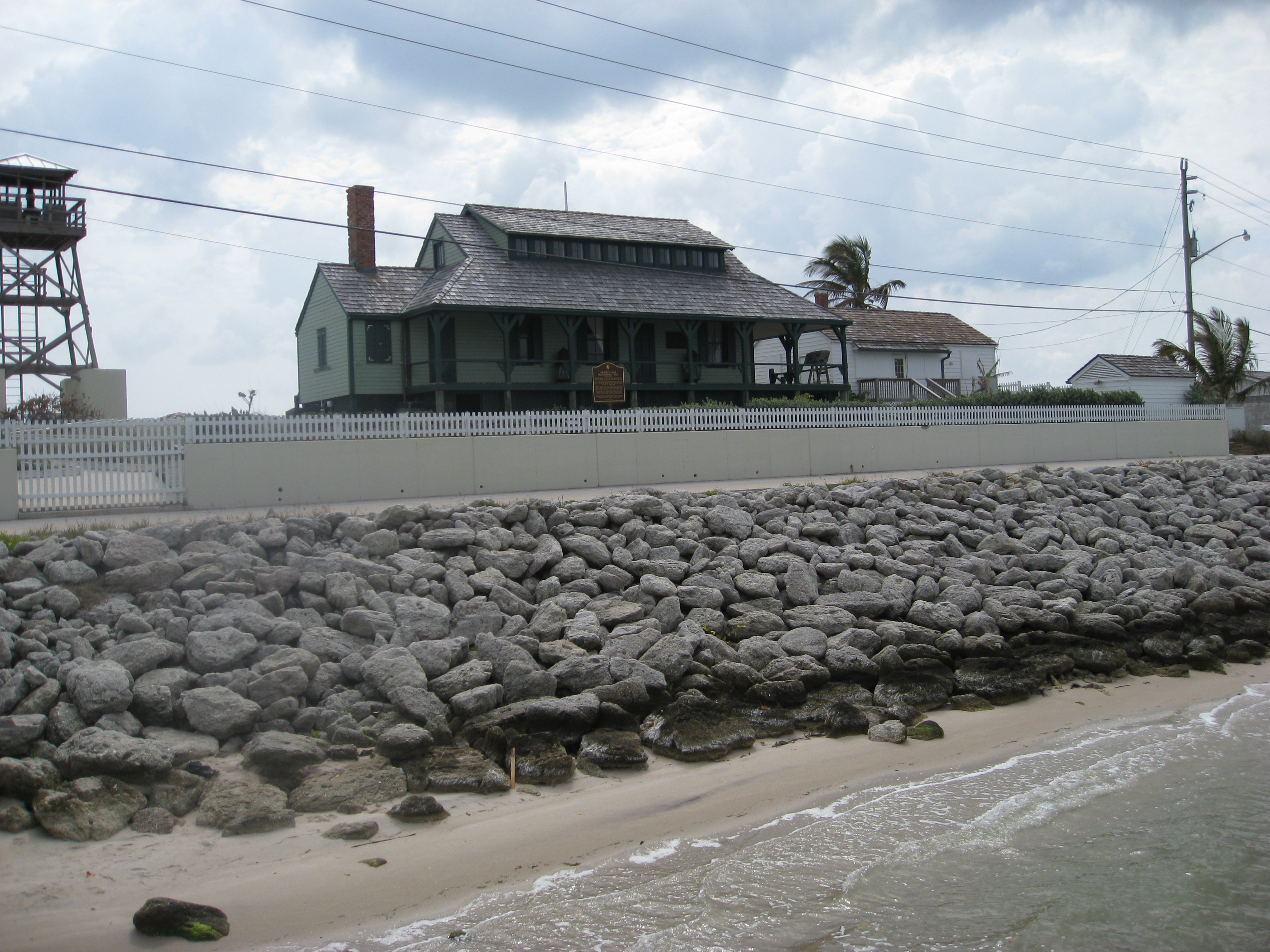
In 1513, Ponce de Leon, seeking the mythical "Fountain of Youth," discovered and named, Florida, claiming it for Spain. Later the occupation of Florida would be held at different times by Spain, France and England, until Spain finally sold it to the United States in 1819. On March 3, 1845 Florida was accepted as the 27th state of the U.S. Shortly thereafter, the Federal government arranged for the initial surveys in Florida. The earliest survey maps were produced and some parts of the Treasure Coast were portrayed as swamps, including parts of North Hutchinson Island. The first records of "white men" on the Treasure Coast reveal a fort being built by Captain Juan Velez de Medrano in 1565, six leagues (A league used to be defined as an hour's walk.) south of the Jupiter inlet. Native Americans called the Ais Indians roamed the area. It was not until the early 1800's that the Seminoles moved south into the area from Alabama and Georgia. In 1807 Spanish authorities granted some 2,000 acres to James Hutchinson. This encompassed land of what we now know as North and South Hutchinson Islands with their name originating from that early owner. In 1821 Spain ceded the territory of Florida to the United States. Efforts had already been underway to push the Seminoles westward. These efforts resulted in resistance and by 1835 the Second Seminole War began and the United States Army began establishing military posts throughout the territory. One of the outposts was a fort built in 1837 on the west side of the river and a little south of what became the city of Ft. Pierce. Lt. Col. Benjamin Kendrick Pierce, commander of the 1st Regiment of Artillery and brother of future President, Franklin Pierce, had proceeded down the coast with his men and found high ground some 10 to 15 feet above water level where they built the fort of palmetto logs and named it Fort Pierce. Although the fort was subsequently destroyed, some floor remnants remain today in a county park accessible from Indian River Drive just a mile south of the County Courthouse. According to Jacob Rhett Motte, an Army Surgeon who had been stationed there, there were no worries about food or water because there was a natural spring of pure water and abundant fish in the ocean and river close by. Motte spoke of "many bonitos, redfish, groupers, sheepshead, trout, and myriads of other kinds unknown elsewhere - of the finest flavor and large dimensions, generally two to three feet in length. As for oysters, six were a comfortable meal for one person, easily obtained, which after removal from the shell measured six to seven inches in length and two to three inches in breadth. We all began to grow fat on this good living. Every day our clothes became tighter."
Fort Pierce remained in operation until August 25, 1842 when the war's end led to its abandonment. During its time, two future Civil War generals were stationed there; William T. Sherman of the Union Army and Joseph E. Johnston of the Confederacy. (For more information on this area see Sacred Shore Article by Jane Gould and Gregory Ennis in the Fort Pierce Magazine, 1988). See link below. http://indianrivermag.com/LIVE/index.php?module=pagemaster&PAGE_user_op=view_page&PAGE_id=136 Congress passed the Armed Occupation Act which took effect August 1842. It provided that any head of family or single man, eighteen or over, could claim 160 acres of land south of Gainesville and Palatka and if: he lived on it for five years, was 2 miles from a garrisoned military post, built a house within one year and put at least five acres under cultivation, it was his. Such land claims extended from Sebastian Inlet on the north to Jupiter Inlet on the south. Settlers lived in primitive dwellings built of pine logs and palmetto leaves. One settler, Col. Samuel Peck, a banker and physician from Augusta, Georgia, had the only frame house. It had been built in Savanna and brought down in a schooner. The old abandoned fort was still used by some for storage, but on the night of December 12, 1843 a fire that started in the old fort's kitchen, destroyed all the fort's buildings and their contents, including the possessions of recently arrived families. In the summer of 1844 the settlers built an inlet through a narrow neck of land separating the river and ocean nearly opposite the mouth of the St. Lucie River. Fresh water from the St. Lucie River had been accumulating in the Indian River for a considerable period of time and ocean tides flowing into the river from the inlet north of Fort Pierce were not sufficient to restore the needed salinity to the water. Salt water fish were disappearing from the Indian River and the oyster beds were being adversely affected. The settlers constructed a ditch across, the sand bar but left a heap on the west side to keep the water from coming through that night while they slept nearby. However, during their sleep the wind changed and blew from the west, causing the water from the river to sweep across the sand heap and break through, almost killing the sleeping men. Pioneer William Peck stated that the inlet remained open for many years and the work accomplished all that had been desired. The detested grass vanished, land and water game returned and the fear of malaria was soon dissipated. Little remains of the Armed Occupation Act colony today. However, on Indian River Drive, south of Fort Pierce, a coquina rock fireplace, built on the property of Capt. William Davis, still stands. The fireplace was located on the gable end of a palmetto covered cabin, the cabin having disappeared long ago. Carved into the fireplace is the date 1844.
Extending from Fort Capron to Fort Brooks in Tampa on the west coast was a military road known as the Capron Trail, for many years the only road connecting the east and west coasts. There was a natural ocean/river inlet across the river from Fort Capron in the area of Pepper Park. Over the years, this inlet was closed off by drifting sands. Fort Capron was abandoned in 1859. The Civil War started two years later, but as the nation was divided and thousands killed, the settlers along the Indian River lived a relatively peaceful existence. Blockade runners did use the Indian River as a haven from Federal ships and in 1865, the Confederate Secretary of War, John Breckenridge, sailed down the river during his escape from Union troops. Just north of Titusville his boat was hauled over land to the Indian River. Breckenridge's party sailed south on the river as far as the Jupiter Inlet, went on to Lake Worth and finally escaped to Cuba.
An oyster cannery was set up and the area around the building became known as Cantown. A general merchandise store was established in the building when it was sold to Mr. Cobb in the mid 1890's. Mr. Cobb operated this business until a few years before his death in 1943. The first Pineapple slips were brought to the area by Captain Thomas Richards from the Keys. A writer for the Southern Sun, a Palatka newspaper, made a trip to the lower Indian River region in 1885 and his impressions were printed in the January 7, 1886 issue. His comments on the fish were: "The great wonder of the St. Lucie County is its enormous shoals of mullet and other fish. Long trails of them, often a half mile in length, can be seen winding their way up and down the river. These trails are usually from 50 to 8O feet wide, and make the water boil and bubble as if a great fire was raging beneath the water of the river." On oysters he said; "they are sold on the spot at 50 to 6O cents per bushel or two dollars per barrel." It is supposed that over 20,000 bushels are taken every season. On oranges, he said: "Round the fort, the land is not cultivated as it should be, yet from an old time planting there are almost 25 acres covered with orange trees sternly disputing possession of the soil with the encroaching forest growth." On pineapples, he remarked: "The Northern tourist when he first gazes upon it can scarcely believe his own eyes, so unlike is it to anything of the kind that he has ever witnessed." Directly north of Fort Pierce was Edgartown, a village located near present day North 2nd Street and Avenue D. The Summerlin family arrived at St. Lucie village during the mid 1880's. The Summerlins were engaged in the fishing industry. Some are quite familiar with the name and the fact that they are still connected with the waters of the Indian River.
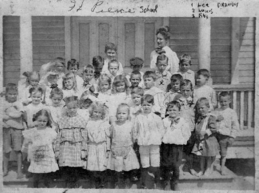
Not until the late 1800's were churches formally organized in the area. A Baptist congregation was formed in 189O with $100 dollars being furnished for building materials and the church was soon constructed on the corner of 4th Street and Avenue A. The Methodists had their first services in Fort Pierce about 1889 in the schoolhouse on the corner of Avenue D and North 2nd Street. The first church was constructed facing east toward the railroad tracks, located at present day 62O North 4th Street. As early as 1891, local Episcopalians held lay reader services in the home of Frank Tyler. Later, services were held at the First Baptist Church. The parish register shows the first confirmation taking place February 26, 1896. Bishop William Gray helped organize the church, known as St. Andrew's. The first Congregational Church was established in the town of Eden on November 11, 1894. Fort Pierce had many surrounding villages. The village of Viking took its name from the numerous Scandinavian families settled there. Near the savannas lived a family by the name of Ankeny. The village of Ankona was named after this family. Another small settlement was called Tibbals and changed to Walton in the early 19OO's after a noted fisherman of that name. The village of White City was so named from the White City section of the Chicago World's Fair of 1893. Cattle became a large industry in the area with many big cattle ranches being formed. It is still a thriving industry today in the western part of St. Lucie County. With the development of fishing, orange groves, pineapple fields and cattle, the natural thing was the emergence of the railroad for shipping. Shipping was done largely by river until the railroad was completed in 1894. This was the Florida East Coast Railroad. Fort Pierce was the business and commercial center of the county. The St. Lucie County Bank was started in 19O8 at Jensen, but with the steady growth of Fort Pierce, the bank was moved north in December, 191O. The bank closed in Jenson at the end of one day it's assets of $6,000 along with it's books were loaded on the cashier's boat and taken north on the Indian River to the bank's new home where it opened the next day without losing a business day. This bank has continued to grow and today is known as Sun Bank. A two story red brick courthouse was constructed in Fort Pierce in 19O8 giving the county an attractive permanent structure for the government. It is rumored that the gallows was built in the yard of the county courthouse and no prisoner was transported to Tallahassee. The townspeople felt that punishment should be delivered immediately and the gallows used. The favorite expression "He ought to be taken out and hung" was appropriate for the time. Entertainment in the early 1900's consisted of beach parties, swimming and boating. Most of this took place along the Indian River and on Hutchinson Island. There was no bridge to Hutchinson Island so families would gather at the downtown dock and board the boat "Surfside" for a trip to the island. On the island, Dr. R. C. Boothe's "Surfside/ Beach Casino was located near the Jetty on South Island. A boardwalk was built for foot travelers to the casino with a cart track along side for chairs, food and incidentals needed for the day of entertainment. This cart was pushed along the track to the beach area. One of the first things that the traveler did was to locate cabbage palm fronds to beat away the mosquitoes that kept control of the island. After the inlet near Pepper Park closed by shoaling the local fisherman had to portage their boats all or part of the way across the island as best they could to get to the Ocean. It wasn't until 1921 that the current inlet was opened. Bahamians guiding mules with scrapers or harrows built the inlet. The News Tribune of May 10,1921, carried the headline: Sea and River "Married" in which it was told how high tides had (washed through the small barrier of sand separating the newly dug channel and the ocean, and had swept the dredge, barges and boats back into the river. A celebration was held on May 12. Included in the program were inspection of the inlet, parachute jump, band music, speaking, a baseball game and street dancing. The inlet was 1,4OO feet long and 2OO feet wide. It was nearly seven feet in depth. Jetties extended out some 6OO feet into the ocean. Some people in the area were not satisfied with an inlet just for fishing and soon looked for better facilities. In 1919 the first bonds were issued for the amount of $80,000 with four subsequent issues through 1928 for a total of $1,850,000. The idea, of course was a deep water port. The Fort Pierce Financing and Construction Company joined in the project to help dig a turning basin and construct slips and a refrigeration warehouse. Government aid was sought but did not come until 1933. Completion of the project came in February, 193O, at a total cost to the taxpayers and Financing Company of $2,500,000. The channel entrance depth was 25 feet, width 240 feet, the cut through the island, the river channel turning basins and slips were 22 feet deep. A celebration took place on February 22, 1933 and the ship, the Betty Weems, was on hand. A convoy of government vessels took members of the official reception to the whistling buoy to meet the Betty Weems. The Port Pilot guided the Betty through the inlet. The Betty Weems brought 146 tons of freight ranging from photographic supplies to automobiles. The inlet was taken over by the government by congressional action in August 1933, the initial appropriation being $250,000 and $50,000 per year for maintenance. Since then the government has maintained and deepened the port. Commerce through the port grew steadily, saving shippers millions of dollars in transportation. A land boom had begun before the great depression. The following promotional advertisement appeared" in September, 1925, part of which read: "The health giving qualities of Florida - air and sunshine, combined with the invigorating effect of salt water bathing, make an ideal spot for the tired in body and mind. Here jaded spirits revive quickly amid the restful surroundings, and weary bodies take on new life and power. Here the pallor of the city gives way to a healthy bronze as day after day is spent 'neath the glory of Florida's azure sky and genial sun. Many and varied will be the recreational facilities which we will provide. These will include a magnificent salt water bathing casino, wading pools for the children, tennis arid croquet courts, bridle paths and an 18 hole golf course with velvety greens and numerous sporty water holes. The first unit is already reserved before opening. Hundreds of deposit checks have been returned to would be purchasers who reservations reached us too late to be accommodated." The advertisement was for the new town of Indrio. The site of the new town was originally known as Viking. Hundreds of full page promotional ads similar in context to that just quoted were published throughout the country. They including engravings of the new town depicting magnificent club building, apartment buildings, recreational facilities, private homes, public buildings and what have you. They further quoted that: Indrio is the practical vision of practical men who combine the financial resources and artistic genius necessary to insure its realization. It was a magnificent layout indeed. The ads were intriguing and they attracted hundreds of buyers. The promoters laid out streets, constructed miles of sidewalks, and built several structures. The new and ideally planned town was a beauty on the drawing boards and in the ads. And then the boom busted. The bottom fell out of it overnight. Indrio flopped into bankruptcy. Hundreds of investors were caught and visions of America's most Beautiful Town vanished in thin air. The few buildings erected were demolished or rotted to the ground. In the early 1900's St. Lucie County had a chain gang made up of county prisoners. They worked on public roads and other county projects. The area also had its share of hobos attracted to the mild weather. Sebastion was in St. Lucie County at that time and had its notorious Ashley Gang. The gang actually started in the late 1890's composed of a group of lawless men who terrorized South Florida, engaging in such things as murder, bank robbery, booze running, train robbery and hijacking. The gang was successfully eliminated by ambush at the south end of the Sebastian River Bridge on November 1, 1924. From 1943 to 1946, Hutchinson Island housed the U.S. Naval Amphibious Training Base. The base and the 140,000 men who went through it left a distinct impact on Fort Pierce and the outcome of World War II. The training grounds were in the approximate vicinity of the Causeway Mobile Home Park and the U. S. Coast Guard station. Not only was the island heavily occupied, but men were housed in Fort Pierce hotels as well. There are a few cement foundations to be found in that area, but most of them have been destroyed. The frog men received their training in the waters of the causeway. New men were taught to swim over to "Dynamite Point" (the area of the state park on North Hutchinson at the causeway), plant their charges and return on the ebb tide. As their training progressed they worked with the swiftest of the tides. Final examinations were the ability to plant their charges on the point having swum over and back in a full strength tide going out of the causeway. The mosquitoes and sand fleas were the worst part of their training. There were records of some suicides and mental problems among the young men stationed for guard duty. The "critters" as they were called, were relentless and showed no mercy on the stationed guards, day or night. Many of the residents brought young men into their houses for meals and entertainment. Most residents of Fort Pierce held the trainees in high regard and still do. Over the years, Fort Pierce has been a part of several counties. Starting in 1810 it was part of East Florida which stretched from the Suwannee River on the north, due west of Jacksonville to the Keys in the south. In 1821, it became part of St. John's County covering the same area. In 184O, it became part of Mosquito County, the boundaries being Saint Augustine on the north and Stuart on the south. In 185O, it was named St. Lucie County and encompassed Melbourne to the north and Stuart to the south and stretching west to Okeechobee. In 188O, it became part of Brevard County and in 1975 back to St. Lucie County. Originally it was pronounced Santa Lucia County and then shortened to St. Lucie. We owe our wild animal population, in part, to the St. Lucie County Code Enforcement Officers. Animal complaints within the county resulted in them being transported to the North Hutchinson Island for release. Later, when development on the island progressed, they were taken to the west end of the county. Many famous people were affiliated with Fort Pierce, one of them being Amelia Earhart. She had strong family ties in this area and was familiar to many. There is much history in the area which many of us now call home. Florida is like the west. It was one of the last southern frontiers. It was being developed as the west was developed. It had its Indians, cowboys and gangs. There were massacres and killings of all kinds. It is difficult to comprehend that the oldest buildings in this area date back to the late 18OO's compared to some in New England dating back to the 1600's. |
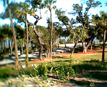
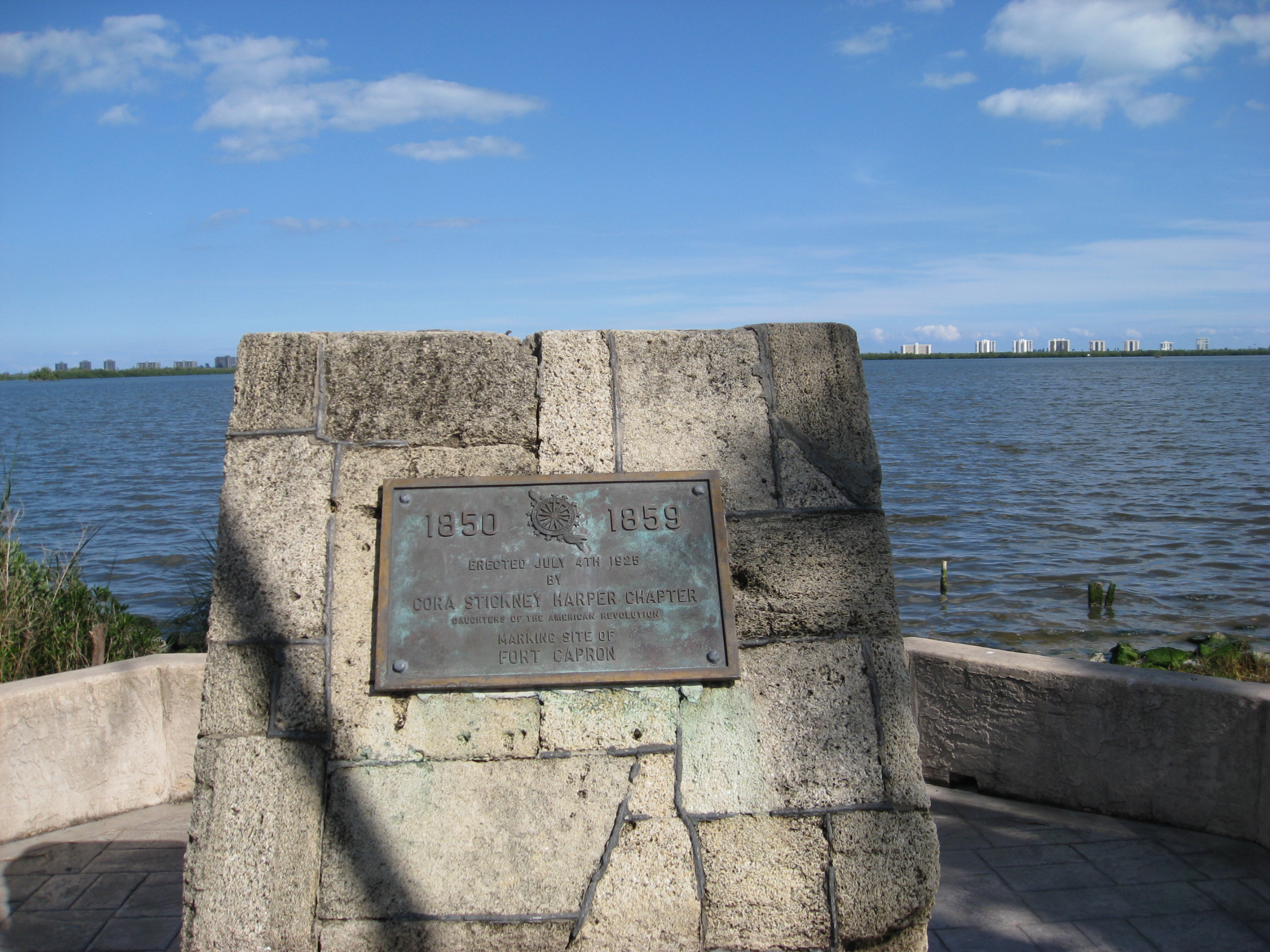 In 1850, a military post, by the name of Fort Capron, was established
in honor of Capt Erastus Capron. Fort Capron was located several miles north of Fort Pierce, at the present location
of the village of St. Lucie. St. Lucie is: small, quaint, and located approximately across from Pepper Park along
the west bank of the river on the mainland. There is a historical marker at the end of St. Lucie Blvd. along the river
marking the old fort location
In 1850, a military post, by the name of Fort Capron, was established
in honor of Capt Erastus Capron. Fort Capron was located several miles north of Fort Pierce, at the present location
of the village of St. Lucie. St. Lucie is: small, quaint, and located approximately across from Pepper Park along
the west bank of the river on the mainland. There is a historical marker at the end of St. Lucie Blvd. along the river
marking the old fort location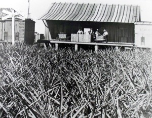 Following
the war a new era began for the settlers of Brevard County - eventually to be St Lucie County. Pineapples and Oysters
became the principle commerce of the area. Pineapples were planted on Hutchinson Island, but the soil proved too rich
and the plantings were moved to the mainland. Extensive, plantings were established in the areas of Orange and Virginia
Avenues. (Photo from :
Following
the war a new era began for the settlers of Brevard County - eventually to be St Lucie County. Pineapples and Oysters
became the principle commerce of the area. Pineapples were planted on Hutchinson Island, but the soil proved too rich
and the plantings were moved to the mainland. Extensive, plantings were established in the areas of Orange and Virginia
Avenues. (Photo from :